Ammonia over the U.S. as observed by AIRS, 2002 to 2016
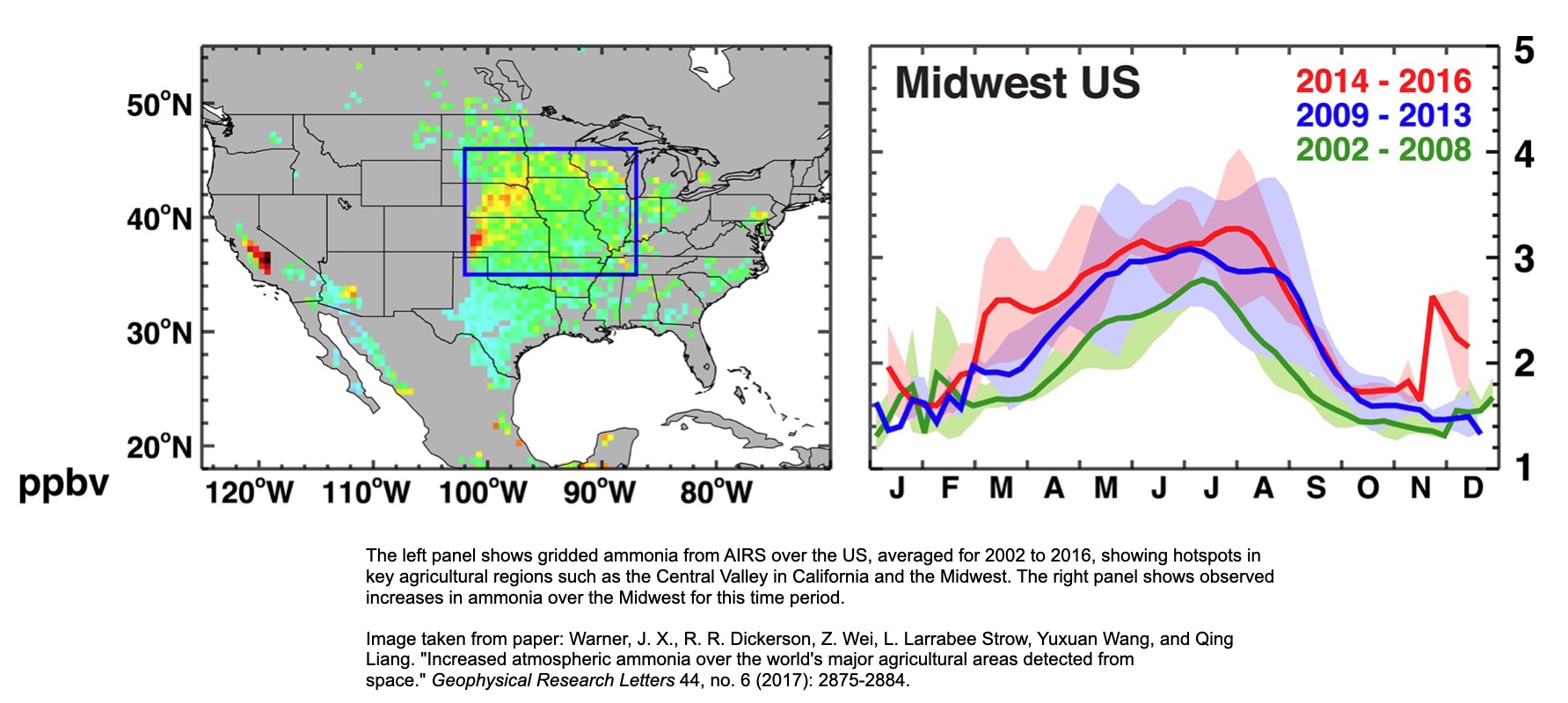
Ammonia (NH3) is emitted from agricultural sources, including crop-farming regions, via the application of fertilizer, as well as livestock operations. As a precursor for fine particulate matter (PM2.5), ammonia has detrimental impacts on air quality and human health. Despite its importance, ammonia is not currently regulated by the EPA. It is also a challenging measurement to make in situ, and ground-based measurements of ammonia are sparse. The extensive spatial coverage and long-term record provided by spaceborne measurements of ammonia from AIRS and other hyperspectral infrared sounders are therefore extremely valuable. The left panel shows gridded ammonia from AIRS over the US, averaged for 2002 to 2016, showing hotspots in key agricultural regions such as the Central Valley in California and the Midwest. The right panel shows observed increases in ammonia over time over the Midwest. AIRS also observed large ammonia signals associated with wildfire plumes. The incidence of large fires is also increasing with time.
There are also some very large NH3 signals from wildfires, and of course the frequency of large fires is also increasing with time.
This image is found in the following paper:
Warner, J. X., R. R. Dickerson, Z. Wei, L. Larrabee Strow, Yuxuan Wang, and Qing Liang. "Increased atmospheric ammonia over the world's major agricultural areas detected from space." Geophysical Research Letters 44, no. 6 (2017): 2875-2884.
