Extent of Pakistan Flooding
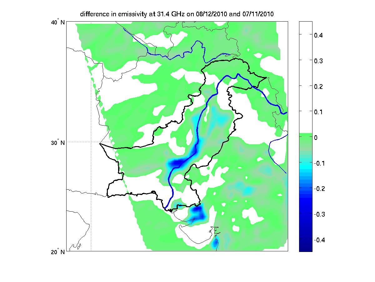
In late July 2010, flooding caused by heavy monsoon rains began in several regions of Pakistan, including the Khyber Pakhtunkhwa, Sindh, Punjab and parts of Baluchistan. According to the Associated Press, the floods have affected about one-fifth of the country. Tens of thousands of villages have been flooded, more than 1,500 people have been killed, and millions have been left homeless. The floodwaters are not expected to fully recede before late August. This image shows how surface emissivity -- that is, how efficiently Earth's surface radiates heat -- changed in the affected region over a 32-day period between July 11 (pre-flood) and August 12 (post-flood). The image was created using data from the Advanced Microwave Sounding Unit instrument, which flies on NASA's Aqua spacecraft as part of the Atmospheric Infrared Sounder (AIRS) instrument suite. Surface emissivity, in this case, in the microwave region of the electromagnetic spectrum, depends strongly on what type of surface is present. For dry land, it is high, close to 1 (land radiates heat very efficiently), while for water, it is quite low, less than 0.5 (water tends to retain heat better than land). The image shows that the emissivity has dropped by up to 0.4 in large areas surrounding the Indus River, indicating that these areas are almost completely under water.
Scientists can use this technique to estimate how much of the land surface has been inundated. A significant advantage of the technique is that it works regardless of time of day and under both clear and cloudy conditions.
