Monster Cyclone Yasi Eyes Australia 2011

Mass evacuations are underway in the northeastern Australian state of Queensland in anticipation of what forecasters expect will be the largest cyclone ever to hit the continent. Yasi has intensified rapidly and currently has winds gusting up to 295 kilometers per hour (183 mph). It is expected to maintain that intensity-equivalent to a Category Five hurricane on the Saffir-Simpson Scale -- until landfall in northeastern Queensland between Cairns and Innisfail during the late evening local time on Feb. 2 (early morning Feb. 2 in the United States).
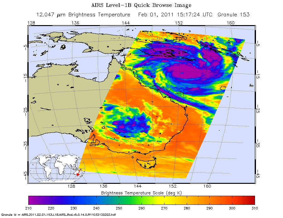
Shown here is the latest infrared image of Yasi from the Atmospheric Infrared Sounder (AIRS) instrument on NASA's Aqua satellite, built and managed by NASA's Jet Propulsion Laboratory, Pasadena, Calif. It was taken on Feb. 1, 2011, at 7:17 a.m. PST (10:17 a.m. EST). A distinct eye is visible, and the outer bands of the storm can be seen nearing the Australian coast.
The AIRS data create an accurate 3-D map of atmospheric temperature, water vapor and clouds, data that are useful to forecasters. The image shows the temperature of Yasi's cloud tops or the surface of Earth in cloud-free regions. The coldest cloud-top temperatures appear in purple, indicating towering cold clouds and heavy precipitation. The infrared signal of AIRS does not penetrate through clouds. Where there are no clouds, AIRS reads the infrared signal from the surface of the ocean waters, revealing warmer temperatures in orange and red.


