AIRS Views Hurricane Beryl over Texas Coast
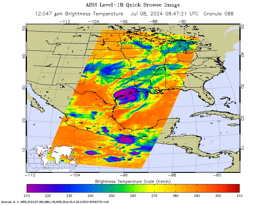
NASA’s Atmospheric Infrared Sounder (AIRS) captured this infrared image of Hurricane Beryl, close to the time of landfall (4 AM local time) near Houston, Texas, in the early morning of July 8, 2024. Beryl has caused the deaths of at least eight people, extreme rainfall and floods, widespread power outages, damages and flight cancellations in Texas and Louisiana. It also killed at least nine people as it went through the Caribbean and Yucatan during the previous week.
In the infrared image, the large purple areas indicate very cold clouds carried high into the atmosphere by deep thunderstorms and associated with heavy rainfall. Warmer areas with shallower rain clouds are shown in blue and green. The orange and red areas represent mostly cloud-free air.
AIRS, in conjunction with the Advanced Microwave Sounding Unit, AMSU, senses emitted infrared and microwave radiation from Earth to provide a three-dimensional look at Earth's weather and climate. Working in tandem, the two instruments make simultaneous observations down to Earth's surface. With more than 2,000 channels sensing different regions of the atmosphere, the system creates a global, three-dimensional map of atmospheric temperature and humidity, cloud amounts and heights, greenhouse gas concentrations and many other atmospheric phenomena. Launched into Earth orbit in 2002, the AIRS and AMSU instruments fly onboard NASA's Aqua spacecraft and are managed by NASA's Jet Propulsion Laboratory in Pasadena, California, under contract to NASA. JPL is a division of the California Institute of Technology.
