News | January 20, 2012
Your paper, three questions: Satellite- and ground-based CO total column observations over 2010 Russian fires: accuracy of top-down estimates based on thermal IR satellite data
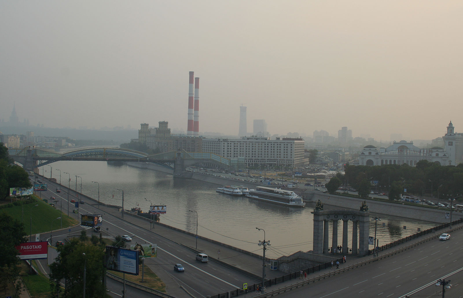
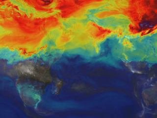
Smog over Moscow after the Russian wildfires of 2010. Credit: A. Savin.
Satellite data is providing researchers with a new way to estimate the amount of emissions from wildfires. While new technology is being utilized, this research also stresses the value of improving the accuracy of spaceborne sounders.
Estimating these [wildfire] emissions quantitatively is not an easy task...Satellite data provides the opportunity for breakthroughs in this research by giving us the ability to make top-down assessments.
What is your paper about?
Wildfires emit gases and aerosols into the atmosphere and impact Earth's climate. In turn,the global climate influences wildfires.Estimating these emissions quantitatively is not an easy task. To date, most estimates have used inventories of emissions, the so-called "bottom-up" approach. Satellite data provides the opportunity for breakthroughs in this research by giving us the ability to make "top-down" assessments.
During combustion, the main product is carbon dioxide while a by-product is carbon monoxide. Carbon monoxide also happens to be one of the most convenient gases to be measured from space. For example, total column carbon monoxide over fires may exceed its normal values by up to 4-5 times, while detected levels of other greenhouse gases are typically no higher than several percent or hardly visible at all. So far, the accuracy of carbon monoxide retrievals estimated in validation campaigns in remote clean areas have been found to be better than plus or minus 10%. However, sounders that use the carbon monoxide band near 4.6 micrometers have low sensitivity at the bottom atmospheric level. In other words, satellites "do not see" extremely high carbon monoxide concentrations near the surface. Validation experiments in areas surrounded by severe wildfires have not been carried out so far.
Wild forest and peat fires occurred in the European part of Russia throughout July and August of 2010. Contrary to other severe wildfires in the boreal belt of the Northern hemisphere, such as those that occurred in Siberia in 2002 and 2003 and in Alaska in 2004, the Russian fires happened in a densely populated area. Less than 100 miles away, Moscow and its environs were covered by the fire plume. As a result, numerous local experimental facilities were able to gather valuable pollution data. For our case, the most valuable data came from two identical sun-tracking spectrometers that were sensitive to the entire troposphere and supplied accurate data for total column carbon monoxide. These data could be directly compared to the satellite data. In addition, surface and tower-based in-situ measurements were available.
What did your research reveal?
During the days of maximum pollution (up to 10 parts per million carbon monoxide in the surface layer), ground-based spectrometers reported the total column carbon monoxide over Moscow to be about 2.5 to 3 times greater than the mid-tropospheric amounts measured by the AIRS and MOPITT satellite instruments. The mid-tropospheric observations from the more sensitive IASI/Metop-A satellite instrument were found to be slightly larger, but still missing about ~ 80% of the total carbon monoxide. We extrapolated these ratios over Moscow onto the entire plume which covered up to 6 million square kilometers, and estimated that the Russian fires emitted between 34 to 40 megatons of carbon monoxide. These ground-based modifications of the satellite observations indicated a maximum daily emitted carbon monoxide of 2.2 megatons per day.
What part of your research do you consider to be the most significant?
We hope our paper will attract attention to the case of using Russian fires for the validation of satellite-based remote sensing of atmospheric composition. We used only 1% of available ground-based measurements in Moscow and other Russian cities impacted by the fires, and the estimate of emitted carbon monoxide that we considered to be reasonable should be verified using more complicated modeling. We also believe that our results for Russian fires could be extended to other severe fires, and top-down satellite-based estimates of emissions should be significantly re-evaluated. Finally, the necessity of improving the accuracy of satellite sounders for carbon monoxide should be stressed.
Abstract, Satellite- and ground-based CO total column observations over 2010 Russian fires: accuracy of top-down estimates based on thermal IR satellite data"
CO total column data are presented from three space sounders and two ground-based spectrometers in Moscow and its suburbs during the forest and peat fires that occurred in Central Russia in July-August 2010. Also presented are ground-based in situ CO measurements. The Moscow area was strongly impacted by the CO plume from these fires. Concurrent satellite- and ground-based observations were used to quantify the errors of CO top-down emission estimates. On certain days, CO total columns retrieved from the data of the space-based sounders were 2-3 times less than those obtained from the ground-based sun-tracking spectrometers. The depth of the polluted layer over Moscow was estimated using total column measurements compared with CO volume mixing ratios in the surface layer and on the TV tower and found to be around 360 m. The missing CO that is the average difference between the CO total column accurately determined by the ground spectrometers and that retrieved by AIRS, MOPITT, and IASI was determined for the Moscow area between 1.6 and 3.3 × 10¹⁸ molec cm−2. These values were extrapolated onto the entire plume; subsequently, the CO burden (total mass) over Russia during the fire event was corrected. A top-down estimate of the total emitted CO, obtained by a simple mass balance model increased by 40-100 % for different sensors due to this correction. Final assessments of total CO emitted by Russian wildfires obtained from different sounders are between 34 and 40 Tg CO during July-August 2010.
[[ADVANCED_SIDEBAR||solid_box||About the author||||/system/internal_resources/details/original/38_leonid-yurganov.png||Dr. Leonid Yurganov is a Senior Research Scientist at the University of Maryland, Baltimore County and the Joint Center for Earth Systems Technology. His current research is connected with the remote sensing of tropospheric composition, focusing on carbon monoxide and other members of the carbon family, and ozone. He received his M.S. from Leningrad State University in 1969 and his Ph.D. from the Institute of Atmospheric Physics in 1979. For many years he has used grating spectrometers for atmospheric research in Moscow and St. Petersburg. From 1995-1996 he studied the total column and surface carbon monoxide abundances at the Geophysical Institute, UAF, Fairbanks, Alaska. From 1997-2001 he worked on the validation of the MOPITT instrument on NASA's Terra satellite at the University of Toronto, and from 2001 to 2006 he studied variations of carbon monoxide burden in the northern hemisphere at the Japan Marine and Earth Science and Technology Center (JAMSTEC) in Yokohama. He is the author or co-author of 44 refereed publications. ||||||||_self]]
