News | August 29, 2021
AIRS captures Hurricane Ida before and after landfall
Before landfall

After landfall


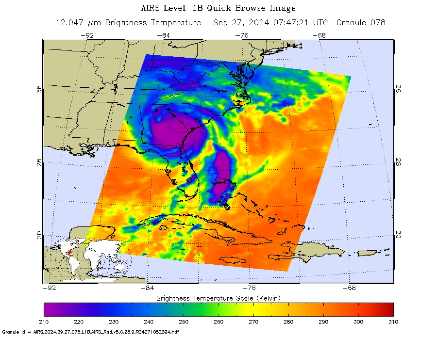
NASA’s Atmospheric Infrared Sounder (AIRS) captured views of Hurricane Ida, both before it made landfall in the early morning hours (2:53 CDT) and approximately two hours after the storm's landfall which occurred around noon local time (CDT) on August 29. The storm came onto land near Port Fourchon, Louisiana as a high-end Category 4 hurricane.
In the infrared AIRS imagery above, the large purple areas indicates very cold clouds carried high into the atmosphere by deep thunderstorms and associated with heavy rainfall. Warmer areas with shallower rain clouds are shown in blue and green. The orange and red areas represent mostly cloud-free air. The eye of the hurricane is seen just over the Louisiana coast as small blue/green area in the middle of the large purple patch. An image is also shown that is taken at the same time at visible wavelengths, by the Visible/Near-Infrared spectrometer that is included with AIRS instrument suite on NASA's Aqua satellite.
AIRS, in conjunction with the Advanced Microwave Sounding Unit, AMSU, senses emitted infrared and microwave radiation from Earth to provide a three-dimensional look at Earth's weather and climate. Working in tandem, the two instruments make simultaneous observations down to Earth's surface. With more than 2,000 channels sensing different regions of the atmosphere, the system creates a global, three-dimensional map of atmospheric temperature and humidity, cloud amounts and heights, greenhouse gas concentrations and many other atmospheric phenomena. Launched into Earth orbit in 2002, the AIRS and AMSU instruments fly onboard NASA's Aqua spacecraft and are managed by NASA's Jet Propulsion Laboratory in Pasadena, California, under contract to NASA. JPL is a division of the California Institute of Technology.