Weather
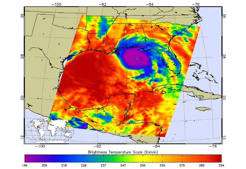
AIRS shows the temperature of clouds or the surface in and around Hurricane Michael as it approaches northwestern Florida around 3:00 AM local time on Tuesday, October 10, 2018.
AIRS and Weather Science
A major goal of the AIRS mission has been to improve weather forecasts by providing more complete atmospheric observations, especially over the oceans. Historically, measurement packages on weather balloons have been the most important source of information about Earth's atmosphere. But weather balloons have limitations. Most balloons are launched over land in select areas, which means the 71% of the world covered by ocean is not sampled. Economic differences between countries also influence coverage. Europe and North America have excellent coverage, while much of Africa, Asia and South America are sparsely sampled.
With its vantage point from space, AIRS makes a total of 2.9 million observations (or 324,000 retrievals) around the globe each day. Measurements derived from AIRS data rival the quality of US weather balloons, but offer a data set that is consistent, uniform, and global.
AIRS data are assimilated at most national operational weather prediction centers around the world, and the inclusion of AIRS data has been proven to increase forecast skill and improve hurricane path prediction. The National Oceanic and Atmospheric Administration (NOAA) assists in development of the AIRS data products and processes and distributes the AIRS data within one to three hours of acquisition to national operational weather prediction centers worldwide.
