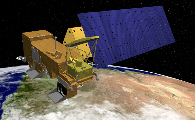
Artist rendering of the Aqua satellite, part of NASA's Earth Observing System. Credit: NASA
The Atmospheric Infrared Sounder on NASA's Aqua Satellite
AIRS is a facility instrument whose goal is to support climate research and improve weather forecasting
Launched into Earth-orbit on May 4, 2002 aboard NASA's Aqua satellite, the Atmospheric Infrared Sounder, AIRS, provides data critical to the monitoring of Earth’s atmosphere. AIRS data are improving weather forecasts and advancing our understanding of Earth’s climate. AIRS is one of six instruments aboard Aqua, a satellite that is part of NASA's Earth Observing System. AIRS along with its partner microwave instrument the Advanced Microwave Sounding Unit, AMSU-A, represents the most advanced atmospheric sounding system ever deployed in space. Together these instruments observe the global water and energy cycles, climate variation and trends, and the response of the climate system to increased greenhouse gases.
" The AIRS instrument has provided the most significant increase in forecast improvement in this time range of any other single instrument. "
The AIRS instrument suite on Aqua
The AIRS instrument suite consists of the hyperspectral AIRS instrument with 2378 infrared channels and 4 visible/near-infrared channels, and the AMSU-A instrument with 15 microwave channels. The Humidity Sounder for Brazil instrument with 4 microwave channels was operational until February 5, 2003.
AIRS and AMSU-A share the Aqua satellite with the Moderate Resolution Imaging Spectroradiometer (MODIS), the Clouds and the Earth's Radiant Energy System (CERES), and the Advanced Microwave Scanning Radiometer-EOS (AMSR-E). Aqua is part of NASA's "A-train", a series of high-inclination, sun-synchronous satellites in low Earth orbit designed to make long-term global observations of the land surface, biosphere, solid Earth, atmosphere, and ocean.
Using cutting-edge technology to observe Earth's atmosphere
AIRS infrared technology creates three-dimensional maps of air and surface temperature, water vapor, and cloud properties. With 2378 spectral channels, AIRS has a spectral resolution more than 100 times greater than previous infrared sounders and provides more accurate information on the vertical profiles of atmospheric temperature and moisture. AIRS temperature profiles have an accuracy in the troposphere that matches the accuracy achieved by radiosondes launched from ground stations.
The advantage of the AIRS suite in orbit is the availability of rapid global coverage. Radiosonde (weather balloon) coverage over much of Earth’s land masses and most of the oceans is nonexistent. There are less than 1000 radiosonde launch sites worldwide with most based in Europe and North America, and most launch only twice per day. AIRS soundings are equivalent to launching 300,000 radiosondes on a 50 km grid over the globe each day.
The infrared spectrum is rich in information about traces gases in the atmosphere, and AIRS also measures trace greenhouse gases such as ozone, carbon monoxide, carbon dioxide, and methane. AIRS data form a "fingerprint" of the state of the atmosphere for a given time and place that can be used as a climate data record for future generations.
A Quintessential Greenhouse Gas Sensor
It comes as a surprise to many, but water vapor is the most dominant greenhouse gas in the Earth's atmosphere. It accounts for about 60% of the greenhouse effect of the global atmosphere, far exceeding the total combined effects of increased carbon dioxide, methane, ozone and other greenhouse gases.
AIRS advanced technology makes it the most advanced water vapor sensor ever built. And AIRS water vapor data is already improving climate models. Beyond water vapor, AIRS measures all the other primary greenhouse gases including carbon dioxide, the largest source of anthropogenic greenhouse gas, carbon monoxide, methane, and ozone.
AIRS Data Are Improving Weather Forecasts
The Joint Center for Satellite Data Assimilation, established to accelerate the assimilation of satellite observations into operational weather forecast models, announced that significant improvement in forecast skill has been achieved with the assimilation of AIRS data.
When compared to the rate of forecast improvement over the last ten years, the improvements made in global forecast capability in a relatively short time are quite significant. A 6 hour improvement in the six-day forecast normally takes several years to achieve.
" The forecast improvement accomplishment alone makes the AIRS project well worth the American taxpayers' investment. "
The quotes above are from the news release "NASA/NOAA Announce Major Weather Forecasting Advancement", August 24, 2005.
