News | August 25, 2015
AIRS Animation Shows Carbon Monoxide Plume Transport from U.S. Fires
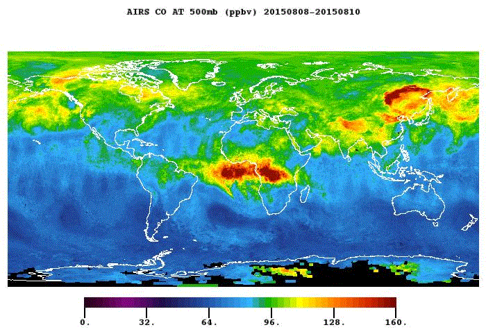
In this animation made with data from the Atmospheric Infrared Sounder on NASA's Aqua satellite, the plume of carbon monoxide released by sixteen wildfires in Washington state can be seen to bloom and transport east, from August 9 through 24, 2015. The AIRS instrument is sensitive to carbon monoxide at roughly 18,000 feet altitude and at this height we can see how the gas is transported eastward along the U.S.–Canadian border, pushed along by the lower reaches of the polar jet stream. The leading edge of the plume reaches the U.S. east coast over the Saint Lawrence Seaway on August 25, five days after it initially became visible by AIRS in the imagery shown here.
Also visible in this animation is carbon monoxide released from Siberian boreal forest wildfires and slash-and-burn agriculture in Africa and South America.
Credit
NASA/JPL AIRS Project